


Best eSIM for Hawaii 2026: Coverage on Oahu, Maui, Big Island, Kauai and Beyond
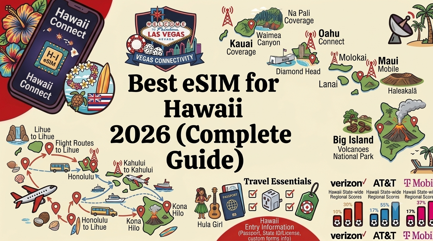
Hawaii is unlike any other US state. Eight major islands spread across 1,500 miles of the central Pacific Ocean, each with its own geography, culture, and connectivity story. Oahu has some of the best wireless coverage of any island destination in the world. Molokai and Lanai have connectivity so limited that they require the same offline preparation as a backcountry wilderness trip. Maui, the Big Island, and Kauai sit in between: well connected in towns and along main highways, patchy in the valleys and mountains that make them so spectacular.
For international visitors — who arrive primarily from Japan, Australia, Canada, South Korea, and the United Kingdom — Hawaii represents one of the most rewarding and logistically complex destinations in the US. Getting a local SIM card is possible but limited: Hawaii's carriers are the same mainland operators (T-Mobile, AT&T, Verizon), but their coverage maps look dramatically different on islands surrounded by ocean than on the connected continental US. An eSIM set up before your departure works from the moment your flight lands at Honolulu International (HNL) or Kahului Airport on Maui (OGG), without any trip to a carrier store or SIM swap.
This guide covers everything you need to know about using an eSIM in Hawaii in 2026, island by island, including which networks perform best on each island, where you will lose signal, and how much data a Hawaii holiday actually requires.
TLDR: eSIM for Hawaii at a Glance
- Best network in Hawaii overall: T-Mobile has invested most heavily in Hawaiian infrastructure and leads on most islands
- Oahu: Excellent coverage across Honolulu, Waikiki, North Shore; best coverage of any island
- Maui: Strong in towns; gaps on the Road to Hana and in Haleakala National Park
- Big Island: Good in Kailua-Kona and Hilo; very limited in Hawaii Volcanoes National Park and remote areas
- Kauai: Strong in Lihue and the coast; limited in Waimea Canyon and Na Pali Coast
- Molokai and Lanai: Very limited; plan to be largely offline
- Recommended data: 8GB to 15GB for a week across multiple islands
- Activate before you fly: Set up your eSIM at home so you land in Honolulu already connected
Why Hawaii Requires Careful Connectivity Planning
Hawaii is a US state, which means US carrier eSIM plans cover it without any additional international arrangements. However, island geography creates connectivity challenges that do not exist on the mainland. Cell towers must be built on terrain that ranges from sea-level beaches to 13,796-foot volcanic peaks (Mauna Kea on the Big Island). Ocean surrounds every island, meaning there is no adjacent coverage to fill gaps at the edges. Deep valleys on Maui and Kauai block line of sight to towers. Active lava zones on the Big Island can make tower placement impractical or impossible.
The result is that Hawaii's coverage map is more fragmented and unpredictable than any mainland US destination. The same phone that gives you 5G in Waikiki will show no bars in the Pololu Valley on the Big Island's North Kohala coast, even though both locations are within the same state and on the same carrier plan.
Understanding this before your trip allows you to plan correctly: download offline maps and trail guides for every island segment where you might lose signal, and use your hotel or vacation rental Wi-Fi for heavy data tasks in the evenings.
You can find the right Hawaii data plan on Esimify — a US eSIM covers all Hawaiian Islands under one plan without any additional steps.
Hawaii Networks: T-Mobile, AT&T, and Verizon on the Islands
T-Mobile in Hawaii
T-Mobile has made the most significant infrastructure investment in Hawaii of the three major carriers and leads for overall coverage depth and consistency across the islands. On Oahu, T-Mobile offers 5G in Honolulu, Waikiki, Pearl City, Ewa Beach, Kapolei, and the North Shore. On Maui, T-Mobile covers the main resort corridors (Kaanapali, Wailea, Kihei) and the main towns (Kahului, Wailuku, Lahaina area). On the Big Island, T-Mobile is strongest in Kailua-Kona and Waimea. T-Mobile tends to have the best coverage on the less-visited outer islands compared to AT&T and Verizon.
AT&T in Hawaii
AT&T has solid coverage in Honolulu and Waikiki and performs well in the main resort areas of Maui and the Big Island. Its coverage in rural Hawaii is less comprehensive than T-Mobile's, but for visitors staying primarily in resort areas and popular tourist zones, AT&T is a fully adequate choice. AT&T tends to have slightly stronger in-building coverage in some Waikiki hotel properties.
Verizon in Hawaii
Verizon has the most limited coverage footprint of the three in Hawaii relative to the mainland. Its strength in rural continental US does not translate as strongly to island geography. Verizon covers Honolulu, Waikiki, and the major Maui resort corridors adequately but falls behind T-Mobile and sometimes AT&T in less-traveled areas. For visitors focused primarily on Oahu's main tourist zones, Verizon works fine. For multi-island itineraries that include Kauai, Molokai, or the Big Island's remote areas, T-Mobile is the stronger choice.
Oahu: The Most Connected Island
Oahu is home to approximately 70 percent of Hawaii's population and receives the vast majority of the state's tourists. Honolulu International Airport (HNL), now officially renamed Daniel K. Inouye International Airport, is the primary gateway for international arrivals to Hawaii, with direct flights from Japan, Australia, South Korea, Canada, and several other countries. Coverage at the airport is excellent on all three networks.
Honolulu and Waikiki
Waikiki Beach and the surrounding resort district in Honolulu have excellent wireless coverage from all three carriers, with T-Mobile and AT&T offering 5G throughout. The stretch of Kalakaua Avenue from the Hilton Hawaiian Village to the Kapiolani Park end has strong outdoor coverage throughout. Major Waikiki hotels have good indoor coverage as well. Diamond Head State Monument, the famous volcanic crater that forms Waikiki's eastern backdrop, has good coverage at the base and trailhead, though it drops in the interior of the crater trail.
Downtown Honolulu (the Aloha Tower Marketplace area, Bishop Street financial district, Chinatown), the Ala Moana Center and surrounding shopping district, and the University of Hawaii at Manoa campus are all well covered. The famous North Shore, including the surfing beaches of Sunset Beach, Pipeline (Banzai Pipeline), and Waimea Bay, has reasonable coverage on T-Mobile and AT&T along Kamehameha Highway.
Pearl Harbor
Pearl Harbor National Memorial, home to the USS Arizona Memorial, the USS Missouri battleship, and the Pacific Aviation Museum, is located about 9 miles northwest of Waikiki. Coverage at the visitor center and across the memorial complex is good on T-Mobile and AT&T. The shuttle to the Arizona Memorial itself (accessed by boat) maintains coverage on the deck. Download the NPS Pearl Harbor app before visiting — it provides audio tours and memorial information that can be used offline.
Oahu's Windward and Leeward Coasts
The Windward Coast (the eastern side of Oahu, facing the Ko'olau Mountains) is home to Kailua Beach, Lanikai Beach, and Kaneohe. Coverage is generally good in the beach towns and along the Pali Highway. The Nu'uanu Pali State Wayside lookout has coverage on T-Mobile. The Windward side is significantly less developed than the Waikiki side and coverage reflects that: strong in Kailua and Kaneohe, less consistent in the rural areas further north.
Hawaii Island-by-Island Coverage Overview
| Island | T-Mobile | AT&T | Verizon | Key Coverage Notes |
|---|---|---|---|---|
| Oahu (Honolulu, Waikiki) | Excellent 5G | Excellent 5G | Strong | Best-covered island; full resort corridor coverage |
| Oahu (North Shore, rural) | Good | Good | Fair | Coverage thins in interior valleys and rural north |
| Maui (Kaanapali, Wailea, Kihei) | Excellent | Strong | Good | Full coverage in main resort corridors |
| Maui (Road to Hana) | Patchy | Patchy | Weak | Download offline maps; signal drops in the rainforest stretches |
| Maui (Haleakala National Park) | Limited at summit | Limited | Weak | Summit at 10,023 feet; download park maps before ascending |
| Big Island (Kailua-Kona, Waimea) | Strong | Good | Good | West coast best served; Kona resort corridor well covered |
| Big Island (Hilo, East side) | Good | Fair | Fair | Hilo town covered; rural Puna and remote East Hawaii limited |
| Big Island (Hawaii Volcanoes NP) | Limited | Weak | Weak | Visitor center area has some signal; remote lava fields offline |
| Kauai (Lihue, Poipu, Princeville) | Good to strong | Good | Fair | Main towns and south/north shore resorts covered |
| Kauai (Na Pali Coast, Waimea Canyon) | Weak to none | Weak | Weak | Download offline maps; these are remote wilderness areas |
| Molokai | Limited (main towns) | Very limited | Very limited | T-Mobile most usable; island is largely rural and remote |
| Lanai | Limited (Lanai City) | Very limited | Very limited | Lanai City has some T-Mobile signal; beach areas largely offline |
Maui: The Valley Isle
Maui is Hawaii's second-most popular island for tourists and the preferred destination for many international visitors from Japan and Australia who seek a combination of beach luxury, outdoor adventure, and cultural experiences. The island's main resort areas — Kaanapali (north of Lahaina), Wailea and Kihei on the south shore, and Kapalua on the northwest tip — all have excellent coverage from T-Mobile and good to strong coverage from AT&T.
Kahului, where Maui's main airport (OGG) is located, has solid coverage on all three networks. Wailuku, the county seat adjacent to Kahului, is similarly covered. Lahaina town on the west coast — devastated by the August 2023 wildfire — is in a significant rebuilding period in 2026. Coverage in and around Lahaina is maintained and access has improved as reconstruction continues.
The Road to Hana
The Road to Hana (Highway 360) is one of the most famous scenic drives in the world — 65 miles of twisting two-lane road through rainforest, crossing more than 50 bridges and passing dozens of waterfalls. It is also one of the most reliably offline driving experiences in Hawaii. Coverage is good leaving Paia on the north shore and in the early stretches. As the road enters the deep rainforest around mile marker 15 and beyond, signal becomes intermittent and often disappears entirely for long stretches.
Towns along the route — Haiku, Keanae, and Hana itself — have some T-Mobile coverage. The Hana area has better signal than the mid-route stretches. The road beyond Hana toward Oheo Gulch (Seven Sacred Pools) in Kipahulu District of Haleakala National Park has essentially no coverage.
Essential preparation: download the entire Road to Hana route on Google Maps offline mode the night before. Download the Gypsy Guide Road to Hana audio tour app while on hotel Wi-Fi. Check the Maui weather forecast the morning you go (coverage at your hotel or vacation rental) — the rainforest sections flood quickly.
Haleakala National Park
Haleakala volcano rises to 10,023 feet above sea level — the highest point on Maui. The summit of Haleakala is one of the most extraordinary places in the Hawaiian Islands, with views above the clouds and a landscape that feels more like a Martian surface than a Pacific island. Coverage at the summit is limited. T-Mobile shows some signal in the summit parking area on clear days when line-of-sight to towers on lower elevations is possible. Reliable coverage should not be counted on above 7,000 feet.
Download the NPS Haleakala app and offline maps before ascending. Summit sunrise reservations are required (book through recreation.gov well in advance), and the road up — particularly the switchbacks above the visitor center — has essentially no coverage.
Big Island: Where Volcanoes Meet the Pacific
Hawaii Island (the Big Island) is the youngest and largest island in the chain, covering 4,028 square miles — larger than all other Hawaiian Islands combined. It is the only island in the world with active lava flows reaching the ocean in recent years, and its geographic diversity is extraordinary: tropical beaches on the west coast, alpine tundra near the Mauna Kea summit, and active volcanic landscapes in the south.
Kailua-Kona and the West Coast
The Kona Coast — from Kailua-Kona town north through Waikoloa and the Kohala Coast resort corridor — is the most visited part of the Big Island and the best served for wireless coverage. T-Mobile and AT&T both offer good to strong signal throughout this corridor. The Hilton Waikoloa Village, Fairmont Orchid, Four Seasons Hualalai, and other luxury resort properties along this coast all have solid coverage. Kailua-Kona town itself, with its historic waterfront and Ali'i Drive restaurant strip, has good T-Mobile and AT&T coverage.
Hilo and the East Coast
Hilo, on the east (rainy) side of the Big Island, is the island's largest city and a hub for travelers visiting Hawaii Volcanoes National Park. T-Mobile is the strongest network in Hilo. Coverage extends along Highway 11 from Hilo toward the park, becoming progressively weaker as you enter the park boundaries.
Hawaii Volcanoes National Park
Hawaii Volcanoes National Park is one of the most unique landscapes on Earth, home to Kilauea, one of the world's most continuously active volcanoes. The park's Visitor Center near the Kilauea caldera rim has limited T-Mobile signal in some conditions. The Chain of Craters Road, which descends 3,700 feet from the caldera to the coast, and the Halema'uma'u Crater overlook area should be treated as offline zones.
Download the NPS Hawaii Volcanoes app and offline maps before visiting. Check lava flow and volcanic emissions (SO2 levels) through the USGS Hawaiian Volcano Observatory website before entering — this should be done on your hotel Wi-Fi the evening before your visit. Volcanic emissions (vog) can be a serious health hazard and require checking forecasts before your visit.
Mauna Kea Observatory
Mauna Kea at 13,796 feet is the highest point in Hawaii and home to some of the world's most important astronomical observatories. The summit access road is unpaved above the Visitors Information Station at 9,200 feet and requires a four-wheel-drive vehicle. Coverage above the Visitors Station is essentially nonexistent. The Visitors Station itself has limited T-Mobile signal in favorable conditions. Download the Mauna Kea Visitor Information Station map and any trail information before ascending.
Kauai: The Garden Isle
Kauai is the oldest of the main Hawaiian Islands geologically and arguably the most scenically dramatic. Its rugged Na Pali Coast, Waimea Canyon (dubbed the Grand Canyon of the Pacific), and Napali wilderness make it the island most associated with Hawaii's wild, untamed side. It is also the island where connectivity drops most dramatically once you leave the main resort corridors.
Lihue, Poipu, and the South Shore
Lihue, where Kauai's airport (LIH) is located, has solid T-Mobile and reasonable AT&T coverage. The Poipu resort area on the south shore, with its beaches and vacation rentals, has T-Mobile and AT&T coverage throughout the main hotel and condo corridor. Koloa town, adjacent to Poipu, is similarly covered.
Princeville and the North Shore
Princeville on the north shore has T-Mobile coverage throughout the resort. Hanalei Bay, the iconic curved beach at the base of the Na Pali cliffs, has reasonable T-Mobile signal. The road west from Hanalei toward Ke'e Beach (the end of the road and the start of the Kalalau Trail) becomes increasingly patchy, with coverage disappearing entirely at Ke'e Beach.
Na Pali Coast and Kalalau Trail
The Kalalau Trail along the Na Pali Coast is one of the most famous and challenging hikes in the United States: 11 miles one way along dramatic sea cliffs to Kalalau Beach, accessible only on foot or by boat. There is absolutely no wireless coverage anywhere along the trail. A permit is required to hike beyond Hanakapiai Beach (the 2-mile mark) and must be booked through the Hawaii Division of State Parks website before your trip. Download all trail and safety information before beginning.
Waimea Canyon
Waimea Canyon State Park, sometimes called the Grand Canyon of the Pacific, is a 10-mile long canyon reaching 3,600 feet deep on Kauai's west side. Coverage at the canyon rim overlooks is very limited. The Koke'e State Park above the canyon, which provides access to the Alakai Swamp Trail, has essentially no coverage. Download offline maps and trail guides before arriving in Waimea town, which has some T-Mobile coverage.
Inter-Island Travel: Connectivity Between Islands
Most visitors to multiple Hawaiian Islands travel between them by inter-island flights operated by Hawaiian Airlines and Southwest Airlines (which entered the Hawaii market in 2019). The main routes connect Honolulu (OGG) to Maui (OGG), the Big Island (KOA for Kona, ITO for Hilo), Kauai (LIH), and Molokai (MKK).
Flight durations range from 20 minutes (Honolulu to Molokai) to about 55 minutes (Honolulu to Kauai). These flights are below the altitude where aircraft Wi-Fi typically operates and are too short for in-flight connectivity to be practical. You will have signal in the departure terminal at Honolulu International and in the arrival terminal at your destination. Your eSIM will work normally on the ground at all inter-island airports.
Note: there is no ferry service between most Hawaiian Islands. Expeditions Ferry operates between Lahaina (Maui) and Lanai, a 45-minute crossing, which maintains limited T-Mobile coverage on parts of the route.
How Much Data Do You Need for Hawaii?
- Week on Oahu only: 6GB to 10GB. Navigation around Honolulu and Waikiki, rideshare (TheBus public transit app for Oahu's excellent bus network), restaurant booking, Instagram from the beach.
- Week on Maui: 6GB to 10GB. Most data used in resort areas; Road to Hana day is largely offline. Use hotel Wi-Fi for heavy tasks.
- Two islands (Oahu and Maui) for two weeks: 10GB to 14GB. Navigation, moderate social media posting, park permit checking, accommodation apps.
- Multi-island trip (Oahu, Maui, Big Island, Kauai): 12GB to 18GB. Four airport transfers, four island navigation downloads, varied resort and adventure activities.
- Honeymoon or luxury resort stay (one island, two weeks): 5GB to 8GB. Beach days have limited data use; most time is at the resort with Wi-Fi. Moderate navigation and restaurant booking.
Tips for Using an eSIM in Hawaii
- Download offline maps for every island before you arrive: This is the single most important preparation step for Hawaii. Google Maps lets you download an entire island region for offline use. Do this for each island you visit while on your home Wi-Fi or hotel Wi-Fi the night before exploring.
- Book national park permits before you leave home: Haleakala sunrise (Maui), Kalalau Trail beyond 2 miles (Kauai), and some Big Island activities require advance online reservations through recreation.gov or the Hawaii DLNR site. These bookings require internet access and sell out weeks in advance.
- Download AllTrails offline trail maps: For any hike in Hawaii, download the trail on AllTrails with offline access before leaving your accommodation. GPS tracking works without cellular signal on AllTrails, which can be crucial for navigation on unmarked or complex trails like the Kalalau.
- Vog forecasts before visiting the Big Island: If you are visiting Hawaii Volcanoes National Park or the Kona side of the Big Island, check the USGS Hawaiian Volcano Observatory website for volcanic emissions forecasts before your visit. People with respiratory conditions should take vog levels seriously.
- Hurricane season connectivity: Hawaii's hurricane season runs from June through November. Download the National Hurricane Center app and the Hawaii Emergency Management Agency app. Having live weather data on your eSIM is essential if severe weather approaches during your trip.
- Sunset times in Hawaii: Because Hawaii does not observe Daylight Saving Time and sits far west in the time zone, sunset occurs around 6:15pm to 7:30pm depending on the season. Plan your Road to Hana or Mauna Kea visits to leave enough daylight — being on these offline roads after dark without GPS is not advisable.
Real-World Scenarios: Hawaii Visitors
The Japanese Honeymooners on Maui
Japan is consistently one of the top source markets for Hawaii tourism, with Maui particularly popular for honeymoons. A couple from Tokyo spending ten days in Wailea and doing a Road to Hana drive would use their eSIM heavily in the resort area (restaurant bookings, spa reservations, navigation around Lahaina) and then go largely offline for the Road to Hana day. A 8GB to 10GB plan covers the honeymoon comfortably. T-Mobile is the recommended network for Maui.
The Australian Adventure Traveler on Three Islands
A solo traveler from Sydney spending three weeks across Oahu, the Big Island, and Kauai. They want to hike to the Kilauea caldera, do the Kalalau Trail on Kauai's Na Pali Coast, and snorkel off Oahu's Hanauma Bay. Heavy offline use on all three islands; data used mainly in towns and at trailheads for booking and navigation. A 12GB to 15GB plan handles three weeks of adventure travel with moderate social media use.
The Canadian Family on Oahu for a Fortnight
A family from Vancouver spending two weeks primarily in Waikiki with day trips to Pearl Harbor, the North Shore, and a day at Kualoa Ranch. Oahu's excellent coverage means they are essentially always connected. They need data for the Pearl Harbor NPS app, North Shore surf spot navigation, and booking activities through Airbnb Experiences. A 10GB to 12GB plan handles two weeks on Oahu with family data use including kids streaming content at the hotel pool.
Frequently Asked Questions: eSIM in Hawaii
Does a US eSIM work in Hawaii?
Yes. Hawaii is a US state, and any US eSIM plan covers all Hawaiian Islands without additional international arrangements. The same plan that works in New York or Los Angeles works in Honolulu, Maui, Kona, and Lihue.
Which network is best for Hawaii?
T-Mobile has the broadest and most consistent coverage across Hawaii's islands and is generally the recommended network for multi-island itineraries. AT&T is a strong choice for Oahu and the main resort corridors of Maui and the Big Island. Verizon has more limited coverage in rural and remote Hawaiian areas compared to mainland performance.
Is there coverage on the Road to Hana?
Coverage is intermittent on the Road to Hana. The early sections near Paia have good signal. The middle stretches through the rainforest (miles 15 through 45 approximately) are often offline or receive only weak signal. Download offline Google Maps for the entire route before leaving your accommodation in Kahului or Kihei.
Can I use my eSIM between Hawaiian Islands?
Yes. The same US eSIM plan works on all Hawaiian Islands without any switching or additional setup. When you land on a new island, your phone connects to whatever tower coverage is available there on the same plan.
Is there coverage in Hawaii Volcanoes National Park?
Very limited. The Visitor Center area near Kilauea caldera has some T-Mobile signal in favorable conditions. The Chain of Craters Road and Halema'uma'u Crater overlook area should be treated as offline. Download the NPS Hawaii Volcanoes app and offline maps before entering the park from Hilo.
Does the Na Pali Coast have cell service?
No. The Na Pali Coast, including the entire length of the Kalalau Trail, has no reliable wireless coverage. Ke'e Beach at the trail's start has essentially no signal. Bring a downloaded offline map, let someone know your hiking plan, and consider a satellite communicator device for emergency situations on the trail.
How do I get from Honolulu to Maui?
Inter-island flights with Hawaiian Airlines or Southwest Airlines take about 30 to 40 minutes and cost roughly USD 80 to 200 one way. Book via the airline apps (which require internet access) before your trip. No ferry service operates between Oahu and Maui. Your eSIM data is active in both the Honolulu and Kahului departure and arrival terminals.
Conclusion: Aloha, and Stay Connected
Hawaii rewards preparation more than almost any other destination in the United States. Its extraordinary natural landscapes — active volcanoes, Na Pali sea cliffs, Haleakala's alien summit, the Road to Hana's rainforest waterfalls — are found precisely in the places where wireless coverage is thinnest. Understanding where you will have signal and where you will not allows you to plan your offline maps, trail downloads, and permit bookings before you leave the comfort of your hotel or resort Wi-Fi.
For the connected portions of your Hawaii holiday — Waikiki's restaurants and shops, Maui's resort corridor, Kona's Ali'i Drive, Kauai's south shore beaches — T-Mobile offers the best overall coverage across the islands. AT&T is a strong alternative for Oahu-focused visits. Verizon is adequate for resort-area travel but falls behind in the destinations that make Hawaii truly special.
Activate your US eSIM before you board your flight to Honolulu at Esimify, and explore guides to every other destination on your Pacific itinerary on the Esimify blog.